While the county has already put in place several policies and programs to improve sustainability and adapt to climate change and sea level rise, the GreenKeys! recommendations exceed the scale of existing efforts. An implementation matrix shows several strategies that can be used to implement the recommendations. These include securing additional funding as well as integrating the recommendations with county planning processes, ordinances, policies, and regulations.
 Monroe County
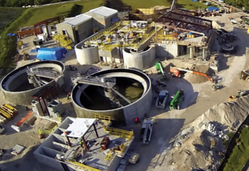
Capital projects maintain infrastructure or acquire capital assets to accommodate future growth. They include construction and rehabilitation of public buildings, major street improvements, parks and recreation projects, and maintenance and acquisition of fleet vehicles.
The county describes its capital improvements in its Capital Projects Plan, which lists each proposed project, the year in which it will be started, and the proposed method of financing it. For Fiscal Year 2016, the County has allocated $115,204,597 for capital improvements.
Guidance for New Capital Project Plan
Assessments and Investigations
Site-level assessments and investigations are recommended to ensure that the county makes capital planning decisions based on facility-specific information, including:
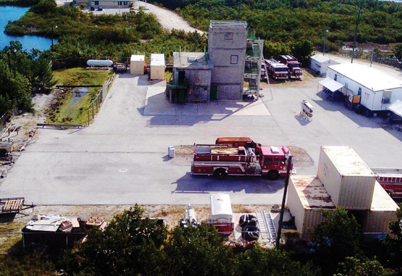
Other Capital Planning In addition to Monroe County’s capital planning, other agencies have relevant jurisdiction over county assets.
For example, the Florida Department of Transportation manages several key public roadways, most significantly U.S. Highway 1—the sole road transport and emergency evacuation route in the Florida Keys portion of Monroe County. As sea levels rise, flooding from tidal fluctuations will become more extensive, causing longer transportation disruptions and damage. During major storm events and other emergency situations, flooding could block low-lying sections of U.S. Highway 1 and would therefore jeopardize public health, safety, and welfare for county residents and visitors.
Florida Department of Transportation (FDOT) Transportation Program
The FDOT plans maintenance activities in the State Transportation Five-Year Work Program (Transportation Program). It is developed through extensive coordination with local and regional governments and planning groups. For Monroe County, FDOT submits the final draft of the program to the Metropolitan Planning Organization (MPO) and the Board of County Commissioners (BOCC). This enables the BOCC to influence the program to ensure consistency with GreenKeys! initiatives.
The following Monroe County projects are listed in the Tentative Transportation Program Fiscal Years 2016/2017 thru 2020/2021.
FDOT Transportation Plan
The Florida Transportation Plan establishes long-range goals for federal and state transportation projects. FDOT is currently updating the plan. Given the importance of U.S. Highway 1, the county should work with FDOT to ensure consistency with the county’s efforts to mitigate and adapt to the effects of climate change and sea level rise.
 Integration with Comprehensive Plan & Code Recommendations
GreenKeys! recommendations can be implemented by integrating them with the county’s Comprehensive Plan and the Code of Ordinances.
The Comprehensive Plan can incorporate recommendations for sea-level rise and resilience in several ways:
Similarly, changes to the Code of Ordinances should be adopted in accordance with the recommendations and timeline in the[GreenKeys! Implementation Matrix]. Comprehensive Plan and code revisions can likely be implemented with existing staff resources or additional outside resources if needed.
 Integration with Community Rating System
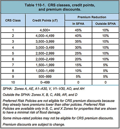
Implementing the recommendations of GreenKeys! will help the County meet several self-initiated goals, including certification by the STAR Community Rating System (CRS). The CRS program compliments many of the recommendations provided in GreenKeys!, including managing development in areas that are vulnerable to flooding and preserving areas of the natural floodplain.
Monroe County is currently applying to the STAR CRS for its first formal rating. Communities can receive credit for activities that increase public safety, reduce property damage, avoid economic disruption and loss, and protect the environment. It includes factors that affect flood risk such as: impervious surfaces in developing watersheds, beach nourishment projects, new fill in floodways, rising sea levels ,and changes in natural functions of floodplains.
While Flood Insurance Rate Maps (FIRM) do not consider these future impacts, CRS incentivizes their consideration in the following ways:
 Funding Opportunities
The fundamental issue for any government responsible for strengthening its infrastructure is the anticipated costs and how to fund them. Construction costs for meeting resilience goals are by far the most significant costs for a government.
However, the costs of infrastructure improvements have to be weighed against the probable costs of future property damage and disruptions to the economy. Science is beginning to establish the link between consistently rising seas and the likelihood of increasing severity of storm surges. Monroe County should therefore weigh these types of potential cost comparisons.
To address funding needs, the GreenKeys! team identified several new funding sources including:
 Monitoring, Reporting and Updates
To ensure that the GreenKeys! planning project is successful, implementation progress should be monitored annually to assess progress. Monitoring and progress updates should occur before, or in conjunction with, the capital planning process. This will give county staff an opportunity to determine current implementation priorities and resource allocation, present updates on efforts initiated during the previous year, and report on the progress of larger scale initiatives.
Another helpful practice is using trigger points to ensure that recommendations are implemented appropriately, especially for medium- and long-term recommendations. Trigger points are monitoring thresholds used to avoid environmental or socioeconomic tipping points, where the impacts become so severe that they are irreversible.
Trigger points can be used to initiate proactive policy changes at the onset of a problem or in some instances avoid problems entirely. This is especially important since many of the adaptation actions recommended in GreenKeys! address problems associated with the projected rapid sea level rise, not the current slower rate of change.
